Himlung Expedition Itinerary
The Himlung Expedition itinerary starts with a short drive to the foothills of the Annapurna mountains and then a beautiful nature-filled cultural trek through Nar and Phu villages to Himlung Himal Base Camp. Himlung is the best 7000-metre mountain to experience a mountaineering expedition in the Himalayas of Nepal.
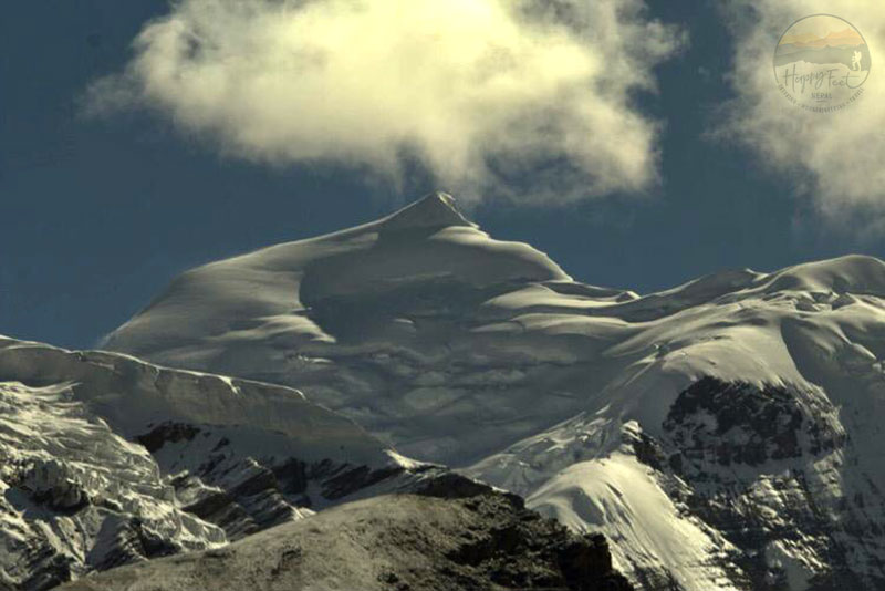
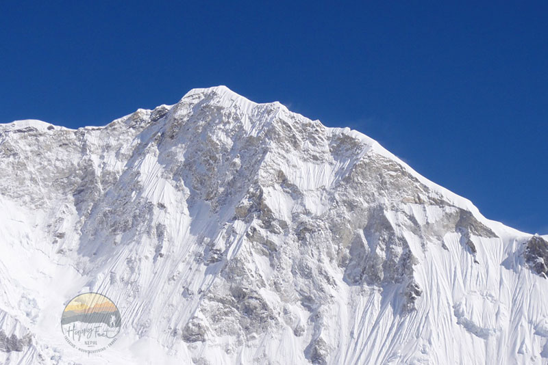
With a height of 7,126 meters, Himlung Mountain is one of the most preferred mountaineering peaks in the Manaslu Region, northeast of the Annapurna range. Since receiving climbing permits in 1992, Himlung has gained recognition within the mountaineering community as a noteworthy peak worth conquering and an attractive option for those seeking adventure and beauty in their climbing pursuits. Himlung, without extreme difficulty, presents a significant challenge for climbers seeking to ascend peaks above 7,000 meters as preparation before attempting higher mountains like Everest or K2. To climb any 8,000 peaks, experience in high-altitude environments is crucial, and Himlung is the perfect peak for all the above terms. The Himlung offers a less crowded access trail and a less crowded climbing experience allowing for a more serene and personal adventure in a tranquil environment. The Himlung Mountain, located at the head of Narphu Valley, is surrounded by other majestic Himalayan peaks, enhancing the overall trekking and climbing experience.
Approach to Himlung Base Camp
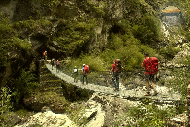
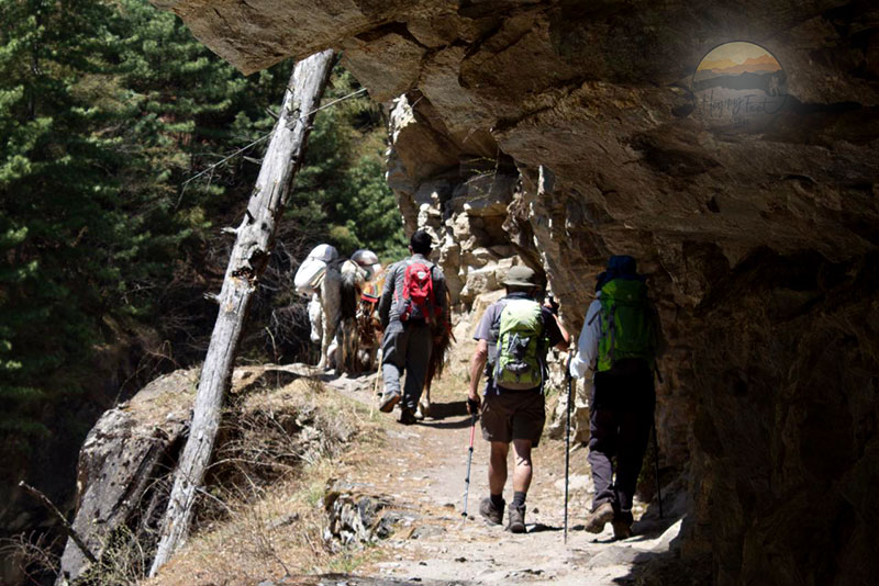
The trail to Himlung base camp is via the renowned Round Annapurna Circuit trail. This trail leads trekkers and climbers through diverse landscapes until Koto, where the trail to Nar Phu branches northeast of Round Annapurna Circuit Trail and enters the Nar-Phu Valley, a region requiring special trekking permits due to its restricted status.
Unique Features of Nar Phu Valley
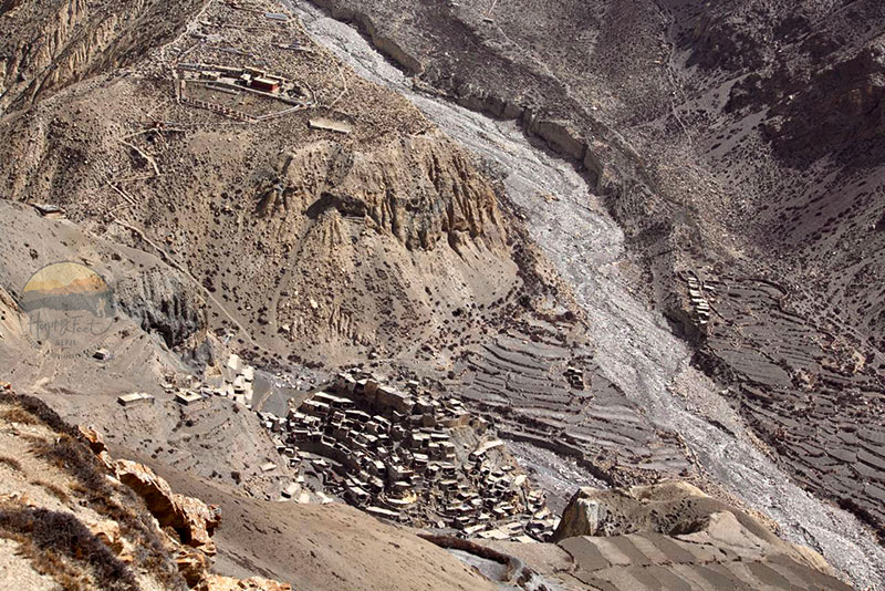
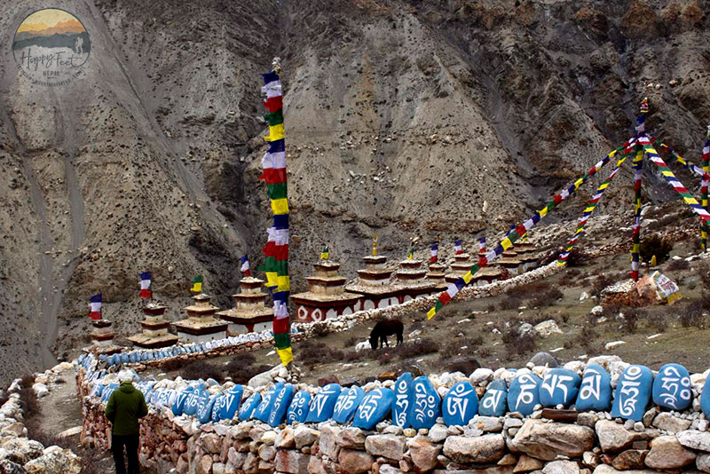
Nar Phu Valley is situated near the Tibetan border, rimmed by high mountains and glaciers. The Nar Phu Valley is a hidden land characterized by pristine natural beauty and rich cultural heritage, offering visitors a glimpse into some of the most authentic villages in the Himalayas, offering unique blend of pristine natural beauty and authentic Himalayan village life. The local cultures and traditions of the Nar Phu remain largely unspoiled by modern tourism, which you will experience in the Manang Region just behind a hill ridge that separates the Nar Phu and Manang Regions.
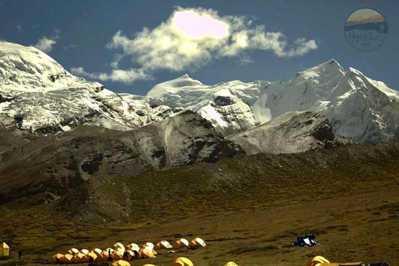
Accessibility to Himlung Base Camp
Despite its remote location, Himlung is surprisingly accessible. A five-hour hike from Phu village, situated at an elevation of 4,850 meters across the Pangir Glacier, brings you to this enchanting narrow valley. The established trekking routes make it feasible for experienced climbers, eliminating extensive logistical hurdles and ensuring a smooth journey to the base camp.
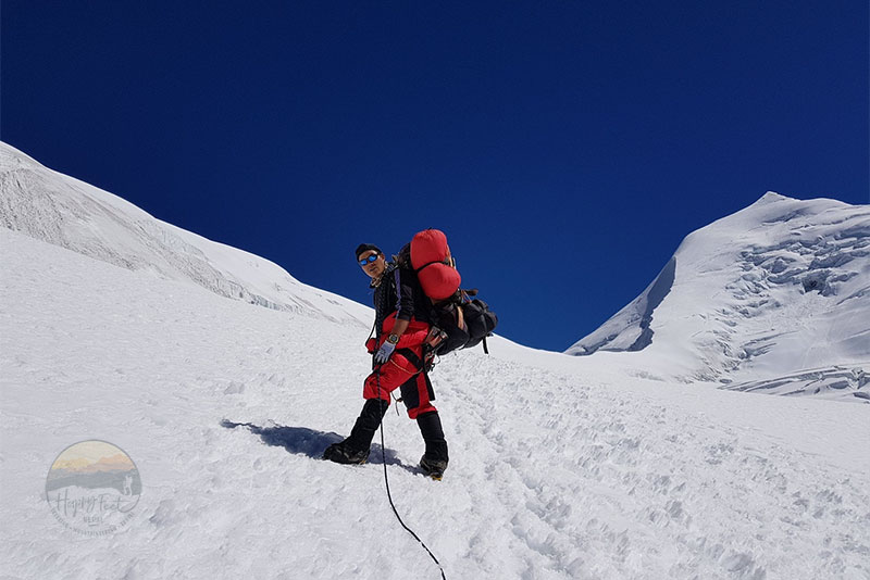
Climbing Camps and Altitudes on Himlung
Above the Himlung base camp, the strategic altitude camps are: Camp I at 5,450 meters, Camp II at 6,000 meters, and Camp III at 6,350 meters. These altitude camps serve as crucial waypoints for acclimatization and preparation for summit. These camps are designed to ensure that climbers are well-prepared and confident before attempting the summit ascent.
Arrive in Kathmandu, clear customs and immigration formalities, and claim your baggage, which takes some time. Upon arrival, receive a traditional welcome from a Happy Feet Mountaineers representative, then transfer to the hotel. Arrive at the hotel, and the rest of the day is free, with optional excursions (not included), or you can ask to organize any of the tours or stroll through its vibrant streets.
Kathmandu, the capital and heart of the country, is home to three medieval cities that symbolize everything in Nepal. Having lived through several Buddhist and Hindu ruling dynasties, the culture and society of Kathmandu Valley have evolved to give it more than just a unique feature. Today, it is an urban city, still rapidly growing, with its ancient myths and testimony to the greatness of the people who have lived there for time immemorial.
A completely free day to do last-minute shopping and repacking the bags to base camp properly. The mountaineering team leader will need to visit the department of the ministry of tourism to sign the document related to the mountaineering permit and responsibilities.
A 8-hour drive.
Nar-Phu valley and Annapurna trekking begin with an exciting overland journey to reach Nepal Mid-West, heading past Besisahar town, the administrative headquarters of Lamjung district. From Besisahar, we switch to a Jeep and continue driving on a dirt road past the villages of Khudi, Bulbule, and Ngadi, following the Marsyangdi River upstream. The drive continues through terraced fields and villages to Syange, a small farming village, for an overnight stop.
A 5-hour trek.
From Syange, the first day’s walk begins with a gradual climb, leaving the Marsyangdi River behind and reaching Jagat, a village with several lodges. From Jagat, the trail levels, with some descents and climbs, to Chamje, offering beautiful views of the Marshyangdi River valley and several waterfalls. Chamje, above the Marshayngdi River, has several lodges where you will stop for lunch. After lunch, cross the Marsyangdi River to the east side within a forested area and climb on a high hill ridge with a view of Annapurna and Manaslu mountains. Then a lovely traverse leads to Tal Besi, with several nice lodges and a beautiful waterfall. From Tal Besi, the trail follows the Marshyangdi valley upstream through a narrow gorge, crossing several dispersed settlements and stunning waterfalls, to Dharapani, a large village at the junction of the Annapurna Circuit and the Manaslu Trail. Most Manaslu Expedition groups start their trek from Dharapani, and the Manaslu circuit trekkers end their walk here.
A 5-hour trek.
From Dharapani, a morning walk leads through rhododendron and pine forests, passing the village of Bagarchap, with a nice view of Annapurna II and the surrounding beautiful hills. Continue following the Marsyangdi River through Danaqu, then climb through a lovely forest to Timang, a tiny settlement with views of Manaslu (8,163m). From Timang, a two-hour trek brings you to Koto for an overnight stop. Koto Kyupar lies near Chame town, the headquarters of the Manang district and the largest settlement in this area, 30 minutes above Koto Kyupar.
A 5-hour trek.
Trek leads through a narrow valley within a forest of pines and rhododendron trees, then reaches a lovely pasture field with huts and sheds of Yak herders. The trail continues in the lower basin gorge formed by Pisang Peak and Kang Guru Himal, following the Nar-Phu River upstream to reach Dharmasala for an overnight stop.
A 3-hour trek.
From Dharmasala, the walk leads past a Shepherd’s hut and a stream, heading north towards Phu village, with a steep climb to a Chorten at 3545 metres. The walk goes on into a bowl-shaped valley and reaches the winter settlement of Meta. The area is also the base camp for Kang Guru (6981 metres). Continue through the abandoned villages of Meta, with empty houses, and reach a Chorten and a trail junction to Nar, with views of the Monastery and Chorten of Nar below. Continue passing several herders’ camps and the second trail branching to Nar, and reach Jhunam with a Chorten at 3645 metres. Jhanum is a former Khampa Soldier settlement from around the 1960s. The effort takes ascending and descending on a glacial moraine stream that climbs to a small pass marked with prayer flags and a grand view of Annapurna behind us. Then a short descent to Kyang, the winter settlement of Phu village. The village has superb views of Pisang Peak (6091m), Annapurna II (7937m), Gyaji Kang (7039 m), Tilje Peak (6530m), and the ridge of Swargadwari (Gateway to Heaven), the impressive rock slab above the Marshyangdi River valley rising more than 1500 metres.
A 6-hour trek.
The morning walk starts through a deserted Phu Khola along a trail carved into a cliff, staying on the east side, passing a wooden bridge far below. Then continue climbing a staircase, passing eroded rocks and windswept, fluted, brown spires. The region is home to snow leopards and several types of mountain wildlife. You may see herds of blue sheep grazing around. Then a steep switchback on a fragile trail brings over the Phupi Gyalgoe Gate, the entrance to the Phu village, with amazing views. Still need to walk, admiring the spectacular approach to the village, past a ruined Dzong (Fort) to a group of Chortens adorned with colourful prayer flags. Finally, cross a long mani-wall and a suspension bridge, reaching the extraordinary village of Phu with about 40 households. The Phu village is surrounded by several meditation caves, ruined Dzongs, and abandoned settlements, explaining its glorious past.
Rest day at Phu and explore the impressive village and Tashi Lhakhang, Samdu Choling Monasteries, and Kyauchyu waterfalls at Phu Village. Tashi Lhakhang, founded by the 10th Gyalwa Karmapa, remains open to visitors, and it is cared for by several nuns. In addition, the monastery has several resident quarters, including the quarter of Lama Karma Sonam, a famous Tibetan Amchi (herbal medicinal and traditional healer) who fled from Tibet with the Dalai Lama. The views of Himlung and Brikuti Peak are seen beautifully.
Acclimatising excursion to Ngoru, a summer pasture and return Phu.
Breakfast and trek to Himlung Base Camp through a deserted moraine following yak trails. The views of Himlung are beautiful. Reach the Kari Koblar basecamp on a lovely grassy slope and continue further crossing the Pangir Glacier. Your Sherpa guides and kitchen staff will already have set up base camp; you’ll get a warm welcome with refreshing drinks, followed by a hearty lunch. Get assigned to your tent and receive your baggage.
Himlung Base camp 4850m
Himlung Base Camp to Camp-1, 5450m.
Access to Camp 1 from base camp is 2-3 hours of easy walking on the moraine in a small valley and no avalanche danger.
Himlung C1 to C2 – 6000m.
The actual climb starts from camp-1, with a rope attached, requiring traversing a scree slope with rock, snow, and crevasses. This part of the climb is one of the trickiest. The campsite is a vast area with enough space for several groups to camp together.
Himlung C2 to C3 – 6350m.
The climb to camp 3 is another comfortable section, with a few ups and downs on icy slopes, and takes a maximum of 3 hours.
Summit Himlung and return to C2.
A long day workout requires an early start, crossing a long, snowy slope at 30 degrees, then onto flat terrain and minor crevasses. Continuing a steeper slope of 36-degrees again, but climbing on a fixed rope for safety and reaching the summit. Essential photographing on the summit of Himlung and return to camp-2 or camp-1.
Return to base camp
Return to base camp, celebrate the success, clean the base camp, and pack to leave.
A 7-hour trek.
A 7-hour trek.
An 11-hour drive.
The expedition team leader must visit the Ministry of Tourism to sign the relevant document. Other members are free to complete their last-day activities.
Breakfast and the rest of the day are leisure on your own. The representative of Happy Feet Nepal will arrive at your hotel with transport three hours before your departure flight time. Get escorted from the hotel to the International Departure Terminal, see off formalities, and go through the immigration and departure.